PITTSBURGH — The cold front is slicing through our area right now, bringing brief heavy rain and wind gusts to 35-40 mph.
Behind this front, temperatures will fall through the 40s this afternoon with wind chills well down into the 30s by this evening. There can be some occasional rain or snow showers, but with little to no travel impacts expected.
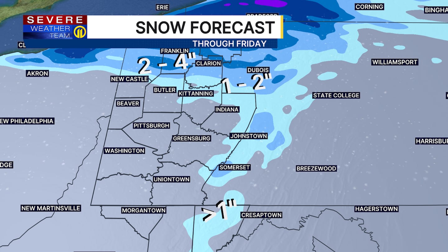
Heavier bands of lake effect snow are expected to develop late tonight and Thanksgiving for areas north of I-80 and mainly north of our viewing area initially. However, some of those bands will slide a bit further south and could reach the I-80 corridor by Thursday night.
Snow showers or flurries can occur on Friday but with no accumulation expected for most of us. Parts of Venango, Clarion and Forest counties can see a few inches of total snow with light amounts possible into northern Butler county as well.
Wind chills will stay in the teens and 20s through Black Friday with cold air holding on through the weekend. Another system could bring us a mix of light rain or snow by Sunday morning.,
Download the FREE WPXI News app for breaking news alerts.
Follow Channel 11 News on Facebook and Twitter. | Watch WPXI NOW
©2025 Cox Media Group
/cloudfront-us-east-1.images.arcpublishing.com/cmg/XCUXZC2XYZHCRGNNGKFEX6U3LQ.png)


