PITTSBURGH — Snow showers could be flying around Saturday morning with a leading disturbance, but only a coating at worst is expected. Steady snow pushes in during the afternoon, with the heaviest snow coming Saturday evening. Plan on snow-covered roads and dangerous travel conditions.
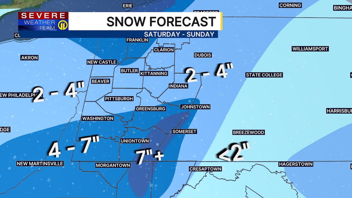
Lake effect snow showers can be expected Sunday, especially north of Butler where locally higher amounts are possible. Combined totals will range from 2 to 4 inches in Pittsburgh but increase to over 4 inches south of Washington and Greensburg. Totals will easily eclipse a half a foot over the ridges, including the ski resorts.
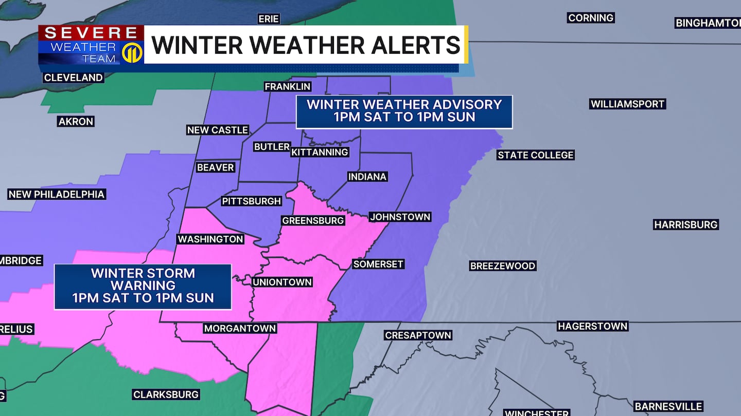
A Winter Storm Warning will be in effect for counties south of Pittsburgh, including Westmoreland, Washington and Fayette, from 1 p.m. Saturday until 1 p.m. Sunday.
A Winter Weather Advisory was issued for the rest of our viewing area, including Allegheny, Armstrong, Beaver, Butler, Lawrence and Indiana counties, for the same time.
The cold and wind will be the bigger headline on Sunday with sub-zero wind chills expected during the morning and barely any improvement during the day.
Cold weather will linger into Monday and early Tuesday before a nice warm up by the middle of next week! A light is at the end of the tunnel!
Severe Weather Team 11 is tracking this snow system hour by hour and will bring you live forecast updates on Channel 11 News and on the Severe Weather Team 11 app.
Download the FREE WPXI News app for breaking news alerts.
Follow Channel 11 News on Facebook and Twitter. | Watch WPXI NOW
©2025 Cox Media Group
/cloudfront-us-east-1.images.arcpublishing.com/cmg/XCUXZC2XYZHCRGNNGKFEX6U3LQ.png)


