It will be breezy with chilly rain showers, and even some small hail is possible early this evening. Colder air will wrap up tonight. Rain showers will change to snow showers as temperatures drop around the freezing mark overnight.
TRACK THE RAIN AND SNOW WITH OUR INTERACTIVE RADAR
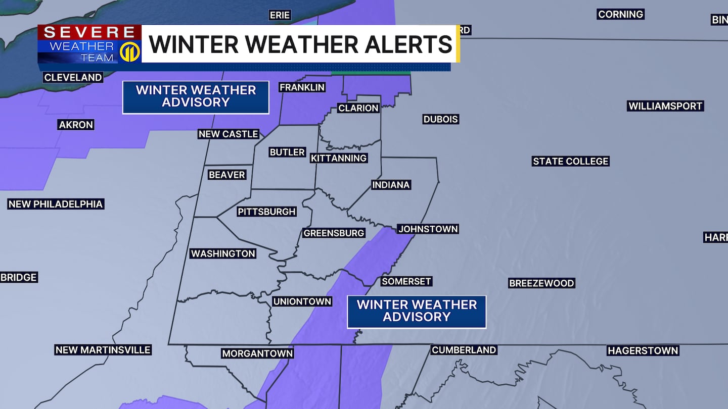
Lake effect snow showers are expected at times from tonight through Tuesday. A Winter Weather Advisory has been issued for the ridges of Westmoreland and Fayette counties, along with western Monongalia and Tucker counties through Tuesday. Our far northern counties are also under a Winter Weather Advisory in Venango, Forest and Mercer counties through Tuesday.
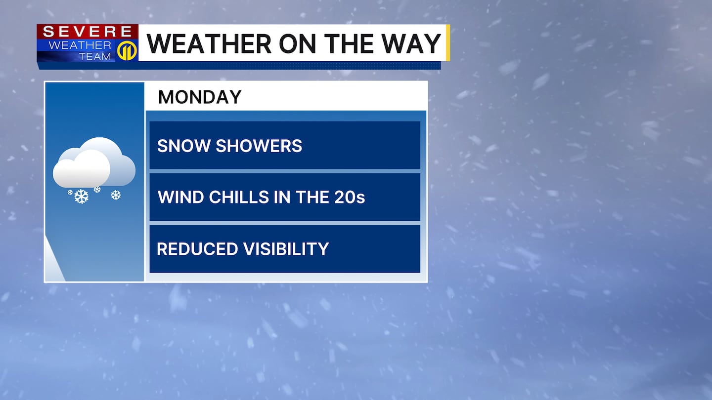
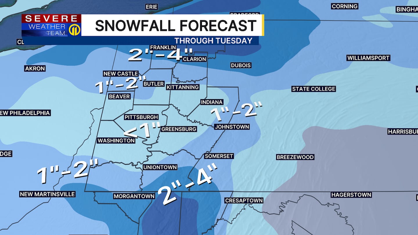
Much colder Monday temperatures will stay steady in the mid-30s with wind chills in the 20s. Snow showers will reduce visibility at times, and as the ground cools off, slippery roads and some snow accumulation are possible in spots from a coating to about 1 inch, with some isolated spots up to 2 inches through Tuesday. Snowfall will be slightly higher north of Route 422 and east in the ridges and mountains, with possibly 1 to 3 inches. Higher snow totals are expected farther north as you get closer to Erie.
It will be windy with clouds and scattered snow showers or flurries on Veterans Day, with highs in the mid-30s. Wind chills Tuesday morning will be in the teens and twenties through the day. More sunshine is expected by Wednesday with warmer temperatures in the upper 40s.
Make sure to check the latest forecast on Channel 11 News. Download the Severe Weather Team 11 App for the latest weather updates and alerts.
Download the FREE WPXI News app for breaking news alerts.
Follow Channel 11 News on Facebook and Twitter. | Watch WPXI NOW
©2025 Cox Media Group
/cloudfront-us-east-1.images.arcpublishing.com/cmg/XCUXZC2XYZHCRGNNGKFEX6U3LQ.png)