PITTSBURGH — A messy winter storm will bring a few light snow showers during the day Wednesday and the threat of freezing rain or sleet by early Thursday morning.
Temperatures during the day Wednesday will climb above freezing, so any snow that falls will melt — leaving roads mainly wet.
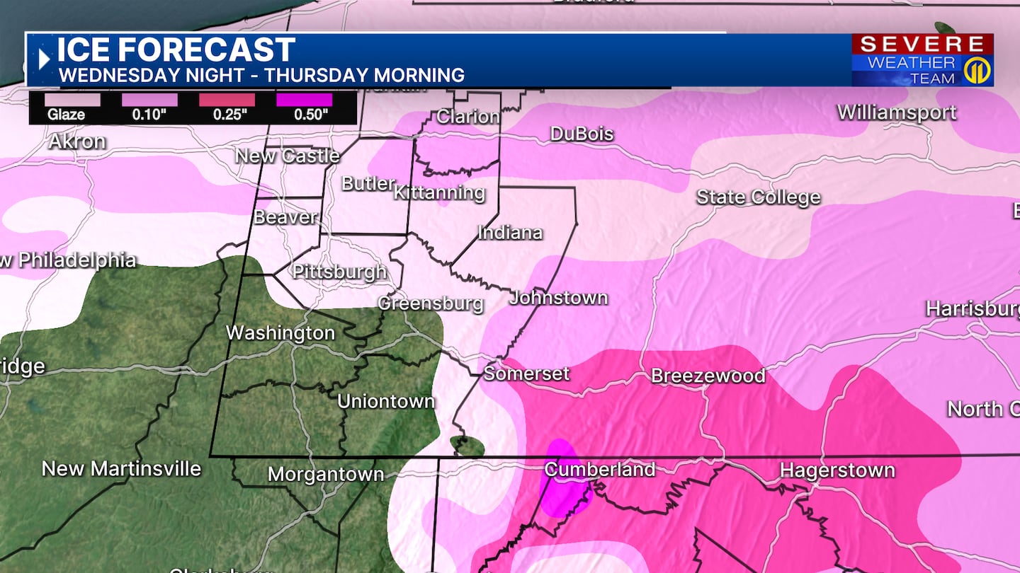
Colder temperatures after dark will set the stage for a wintry mix of light snow, freezing rain and possibly sleet around midnight. A light glaze of ice from I-70 north could develop by 5 a.m., leaving roads and sidewalks slick. It is also possible that some areas see a switch from freezing rain to rain over a short distance, so plan for quickly changing road conditions and hazardous travel.
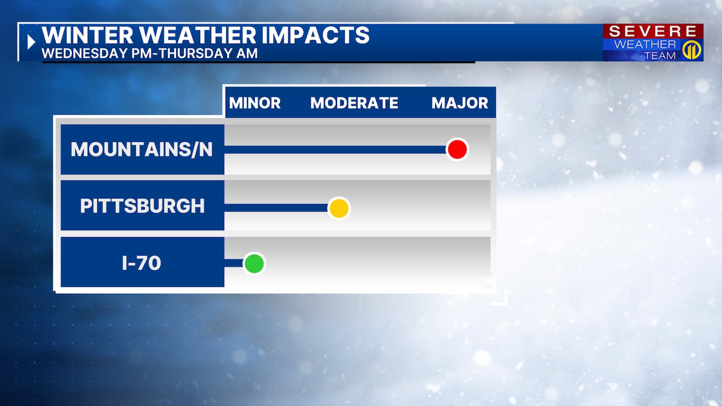
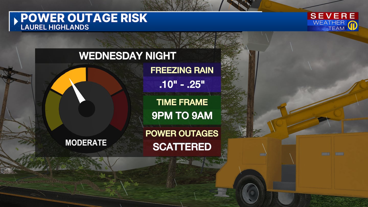
Colder temperatures north of Rt 422 and east in the higher elevations of Westmoreland, Fayette and Indiana counties will allow more ice to form and could create the threat for downed trees and power lines.
Warmer temperatures will change the wintry mix to rain through the morning for most areas but delays to the morning commute will be possible.
A Winter Weather Advisory has been issued from Washington County north and east to the higher elevations where an Ice Storm Warning has been issued.
This is a complicated system, and the forecast will change so stay with Severe Weather Team 11 for the latest updates and have the Severe Weather Team 11 app for alerts, watches and warnings.
Download the FREE WPXI News app for breaking news alerts.
Follow Channel 11 News on Facebook and Twitter. | Watch WPXI NOW
©2025 Cox Media Group
/cloudfront-us-east-1.images.arcpublishing.com/cmg/XCUXZC2XYZHCRGNNGKFEX6U3LQ.png)


